- Cross-border database on the cultural heritage of the Slovenian-Hungarian cross-border region – from 120 selected settlements of the Prekmurje Region in Slovenia and Vas County in Hungary
Archive Material

Problem areas in the floodplain of the Rába and the Vörös Creek
document
Kovátsits Sigmond
1840
Paper
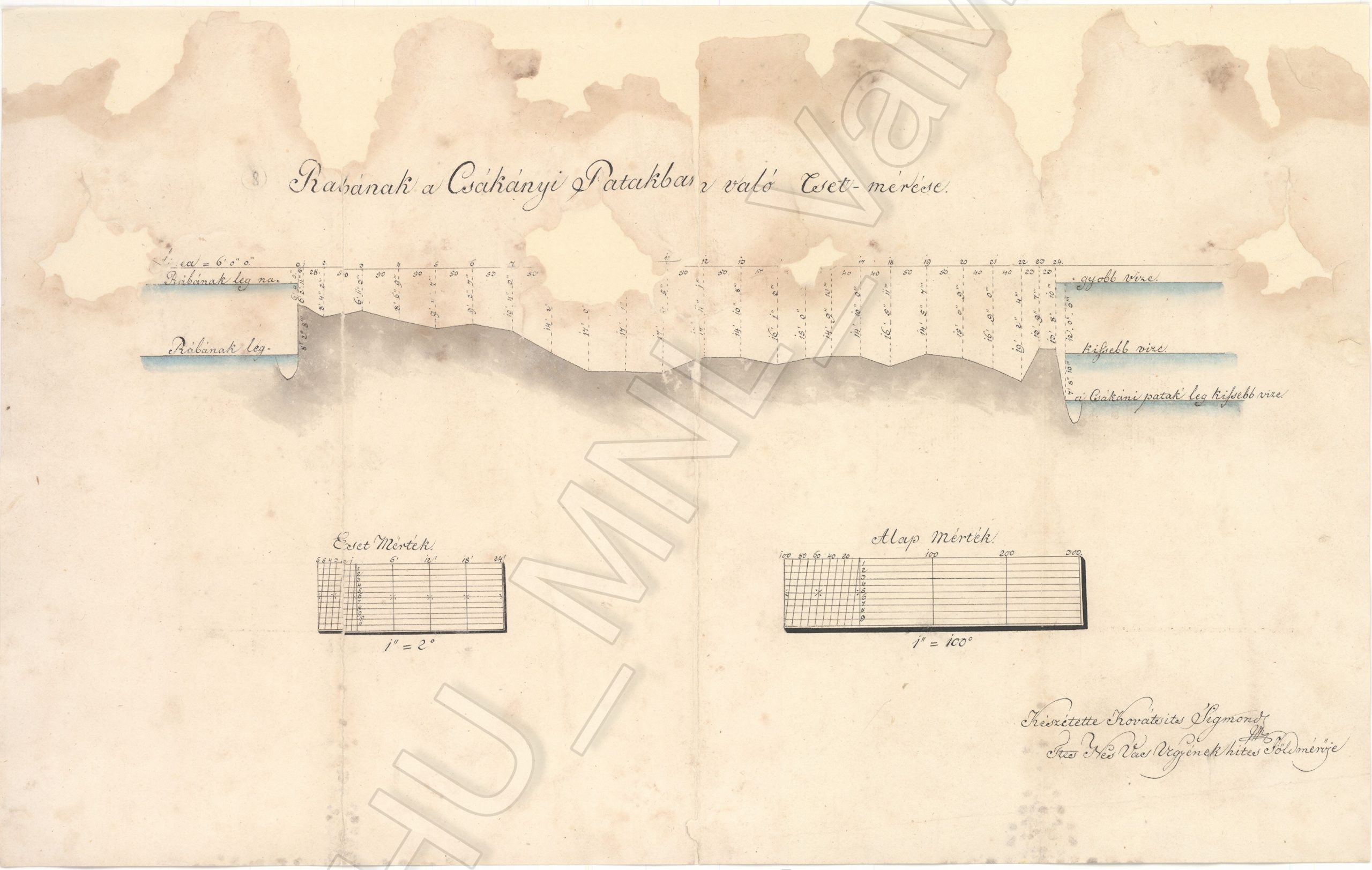
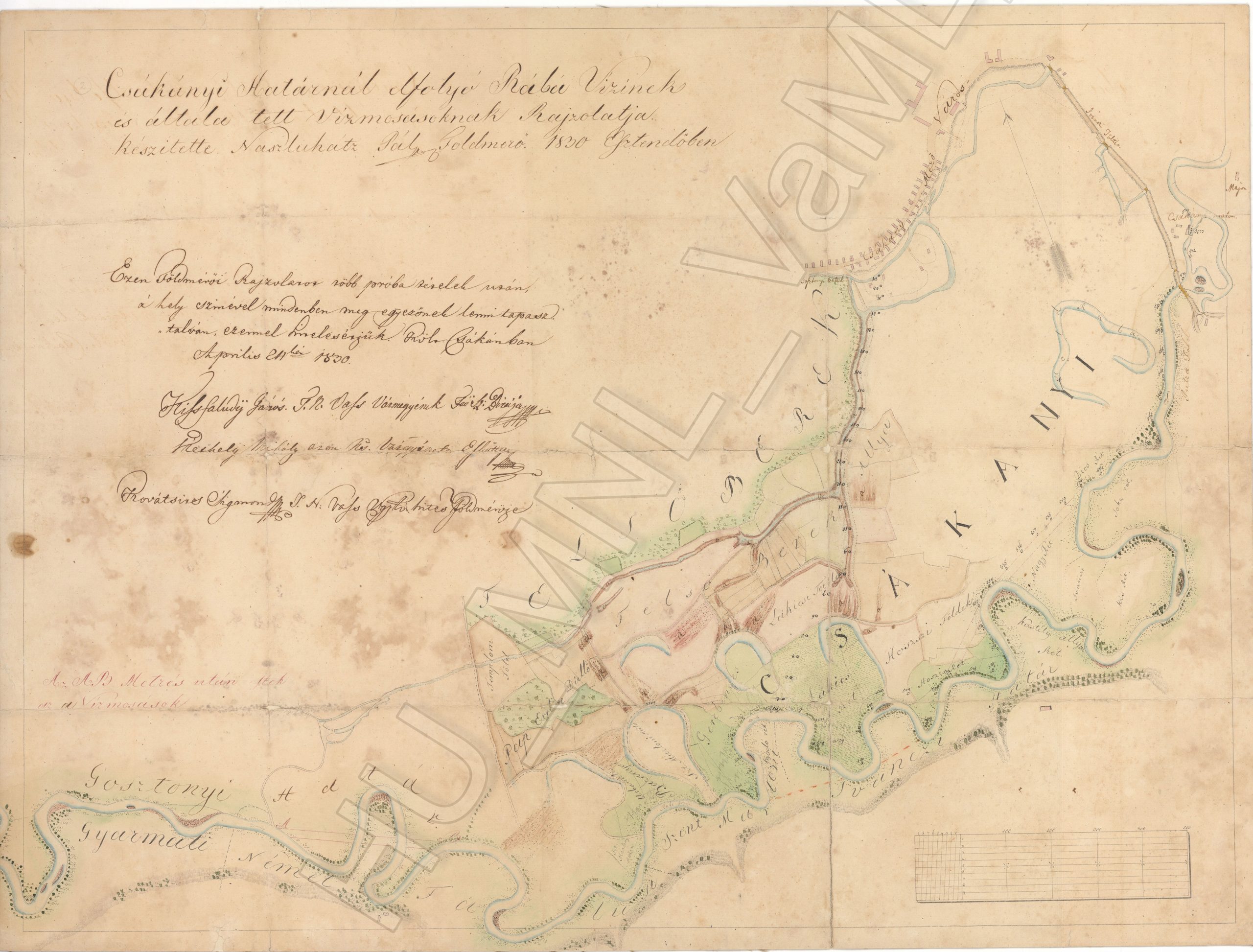
The Rába section at Ivánc is extremely problematic in terms of flood protection. The survey chart here explains this: you can see that the Rába is in a river bed that is about two meters higher than the Vörös Creek. A few kilometers further down, it actually merges into the deeper section, and from there it continues together with Csörnöc, (which, on the lower sections, is called Herpenyő) the southern side - which collects the water of the Hegyhát springs. At high water levels, the river and the creeks are merged and they become almost like a sea.
Information on digitization
- Name of site
- Ivánc
- Size description
- Az oldalak méretei
- Length
- 2 lap
- Place of origin/discovery
- Szombathely
- Specialist description
- Lásd még: Csákány, hídépítés, Ivánc, Rába és Vörös-patak, MNL VaML XV. 1. a. T2 térképek (HUNGARICANA on-line adatbázis)!
- Name of institution or personage holding object; identification number of object
- Magyar Nemzeti Levéltár Vas Megyei Levéltára; HU_VaML XV. a. T 3 HU_VaML XV. a. T 2
- Written sources
- Sziklay János – Borovszky Samu (szerk.): Magyarország vár-me¬gyéi és városai, VI. (Vas Vármegye) Budapest 1898.
- Web page
- https://maps.hungaricana.hu/hu/MegyeiTerkepek/4515/?list=eyJxdWVyeSI6ICJISUVSPShNZWd5ZWlIaWVyYXJjaHktMTkpIn0
- File name
- MNL_VaML_0051_B_0017 - MNL_VaML_0051_B_0018
- Resolution
- 72 dpi, 300 dpi
- Restrictions on use
- Korlátozás nélkül
- Date of documentation
- 2018-10-29
- Person documenting
- Kóta Péter
Photo gallery