- Cross-border database on the cultural heritage of the Slovenian-Hungarian cross-border region – from 120 selected settlements of the Prekmurje Region in Slovenia and Vas County in Hungary
Archive Material

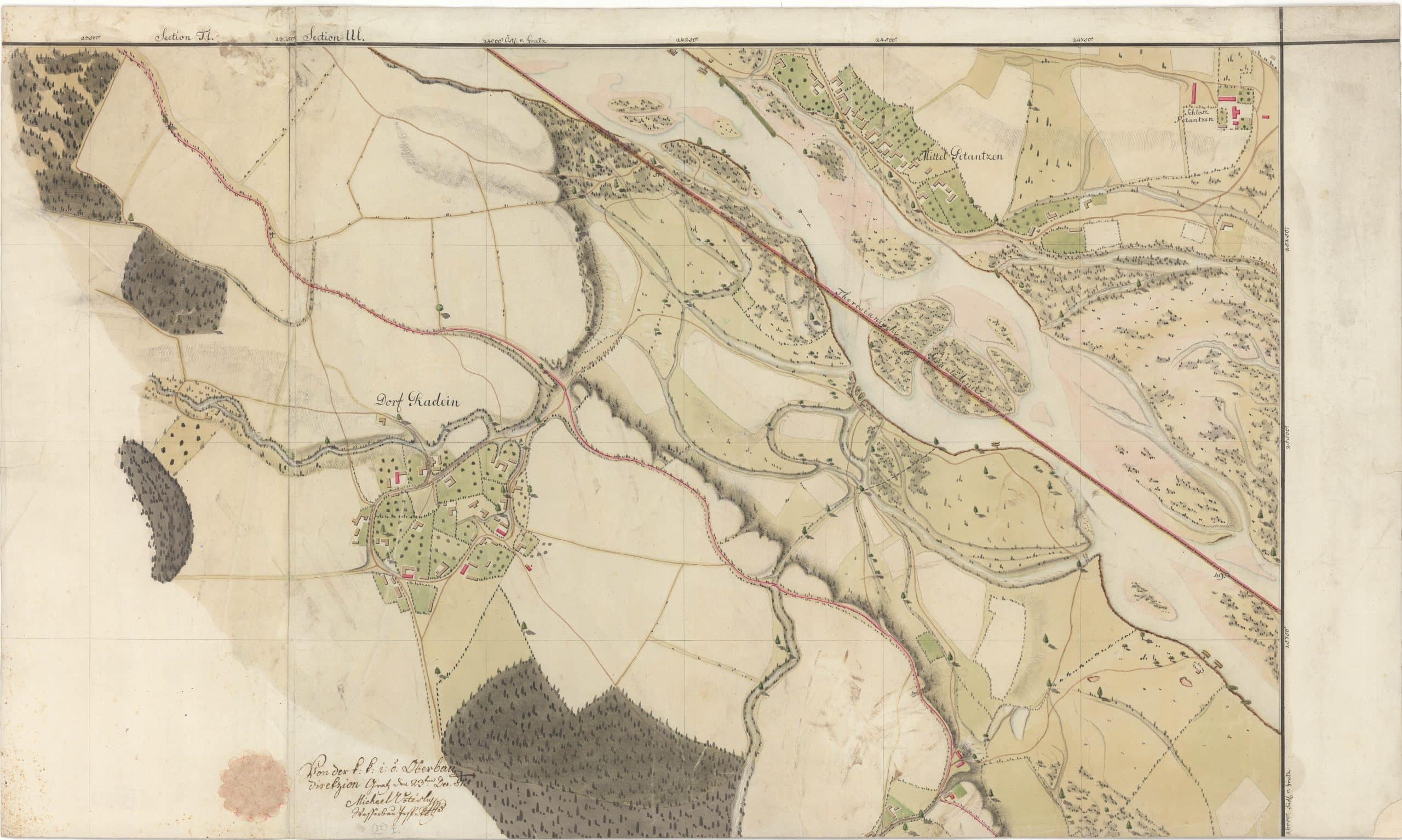
Map of Középpetánc; Petanjci and surroundings
document
Michael Votesky
1815. 12. 23.
Paper
The uncontrolled branches of the River Mura have caused constant border disputes between the Kingdom of Hungary and the Styrian Principality. This map is a piece of a larger compilation, its most important data being the state boundary established in 1755. Its value and its problem at the same time is that it is more detailed but is showing serious differences compared to the Military Survey 2, which was made shortly afterwards - for example, regarding the location of the castle.
Information on digitization
- Name of site
- Petanjci
- Other settlement names
- Petánc (Alsó- Közép-, Felső-)
- Size description
- Az oldalak méretei
- Length
- 1 lap
- Place of origin/discovery
- Graz
- Specialist description
- Erről a térségről – éppen vitatott volta miatt – nagyon sok térkép maradt fenn, pl. MNL OL S 11. 635.g. 1829-ből.
A katonai térképeket a Mapire weboldalon lehet összehasonlítani. - Name of institution or personage holding object; identification number of object
- Magyar Nemzeti Levéltár Vas Megyei Levéltára ; XV. 1. VaML Térképgyűjteménye T 30/1. HU_MNL_VaML_XV_1_a_30_1
- Web page
- https://mapire.eu/hu/map/europe-19century-secondsurvey/?bbox=1782661.5677506833%2C5882168.856422889%2C1797203.7123819382%2C5886946.1706907125&layers=158%2C164 https://maps.hungaricana.hu/hu/MOLTerkeptar/2132/?list=eyJxdWVyeSI6ICJTIDExIE5vIDYzNSJ9
- File name
- MNL_VaML_0096_B_0013
- Resolution
- 300 dpi
- Restrictions on use
- Korlátozás nélkül
- Date of documentation
- 2019-08-14
- Person documenting
- Kóta Péter
Photo gallery

